With satellite imagery dating as far back as 1984, Loic Dallaire has generations' worth of fodder for his master's project – documenting Vancouver Island herring spawns from space.
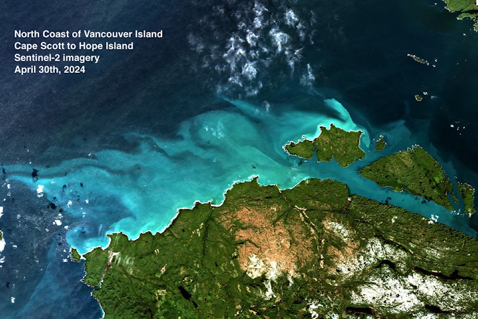
The picturesque overhead images show large swaths of sea turned a tropical teal by herring milt – a sperm-containing fluid from male herring and a key indicator of herring spawn.
With the Spectral Remote Sensing Lab in UVic’s department of geography, Dallaire is working to develop a satellite-based monitoring system. His research, in collaboration with the Pacific Salmon Foundation, aims to enhance existing tracking methods by providing a broader and more consistent view of spawning events along B.C.’s coast. He’s also working with Island Marine Aquatic Working Group – an Indigenous collaborative of 15 nations from three language areas on Vancouver Island – which provides advice, guidance and recommendations to Indigenous organizations and Fisheries and Oceans Canada (DFO).
The DFO, which manages fisheries, has a big data set starting from 1951, generally gathered by flying planes during core spawning season covering primarily the key regions known for the activity, roughly Nanaimo to Campbell River.
They report what they can see from the sky and then assess the amount of eggs laid in specific areas, on seaweed and beaches using other techniques.
“But they know it’s lacking lots of potentially important ecological, traditional events to have a full picture of information,” Dallaire said.
“With the satellite, we can easily look basically anywhere. We can expand the time, season and area.”
Dallaire figures he’s one of the first people to use satellite imagery this way. The idea is to complement the DFO data with the near real-time satellite observations of spawning events.
He started on his master's in September 2023 and spent last year in the field. While on track to finish his master's by the end of summer, plans are already underway for future uses of the technique.
The 2027 goal is to have an interactive tool that allows anyone, particularly First Nations as partners and those most concerned, to track spawning across B.C., Dallaire said.
“We want to slowly start surveying what could be useful for people – what they would need. How familiar are they with this kind of data? What are they most interested in?”
Herring spawns happen now through the end of March and when spotted, tend to inspire average residents as well.
“It’s very engaging for sure for anyone,” Dallaire said. Even the spectacle of a small spawn tends to attract birds, seagulls, sea lions, seals, fisherman and people on the beach. “It becomes a big party.”
The hot spots are mid-Island with famous grounds near Denman Island, Qualicum and Comox Spit. Greater Victoria gets rare small spawns.
Follow online at .


