UPDATE: 10:30 a.m.:
A smoky skies bulletin is underway across the Okanagan and Shuswap.
“These regions are being impacted or are likely to be impacted by wildfire smoke over the next 24-48 hours,” the Environment Canada bulletin reads.
“Winds across the province are expected to shift several times in the next 24-hours. Expect smoke conditions to also change rapidly over both space and time.”
People with lung disease, such as asthma, or heart disease, as well as older adults, children, pregnant people and people who work outdoors are at higher risk of experiencing health effects caused by wildfire smoke.
ORIGINAL
Slightly cooler temperatures are forecast throughout the Okanagan and Shuswap today (Saturday, Aug. 19) as fire crews continue to fight dozens of wildfires in the region.
There are no thunderstorms, and also no precipitation in the forecast, with temperature highs around 26 C.
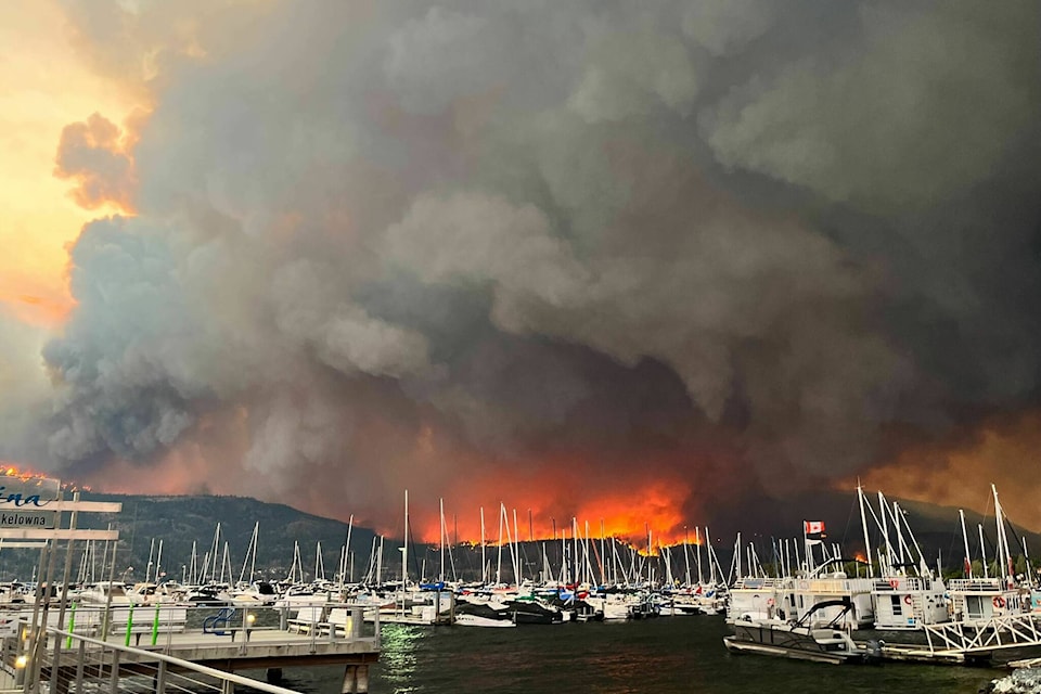
Winds are expected to be around 20 km/h, gusting to 40. High winds Thursday night (Aug. 17) fuelled the McDougall Creek wildfire in West �������� and blew large embers across Okanagan Lake sparking fires in the Clifton/McKinley areas of ��������, which in turn started a wildfire in Lake Country.
Environment Canada still has an air quality statement up from Salmon Arm to Osoyoos, due to wildfire smoke.
Sunday’s forecast looks much the same.
There is no precipitation expected until the middle of next week, with a 60 per cent chance of showers on Tuesday and Wednesday.
Premier David Eby declared a provincial state of emergency Friday (Aug. 18). Residents are urged to avoid non-essential travel to areas affected by wildfires.
READ MORE: OKANAGAN WILDFIRES: What you need to know for Saturday, Aug. 19
READ MORE: B.C. declares state of emergency over wildfires
gary.barnes@kelownacapnews.com
Like us on and follow us on and subscribe to our daily and subscribe to our daily newsletter.


