UPDATE: 4:45 p.m.
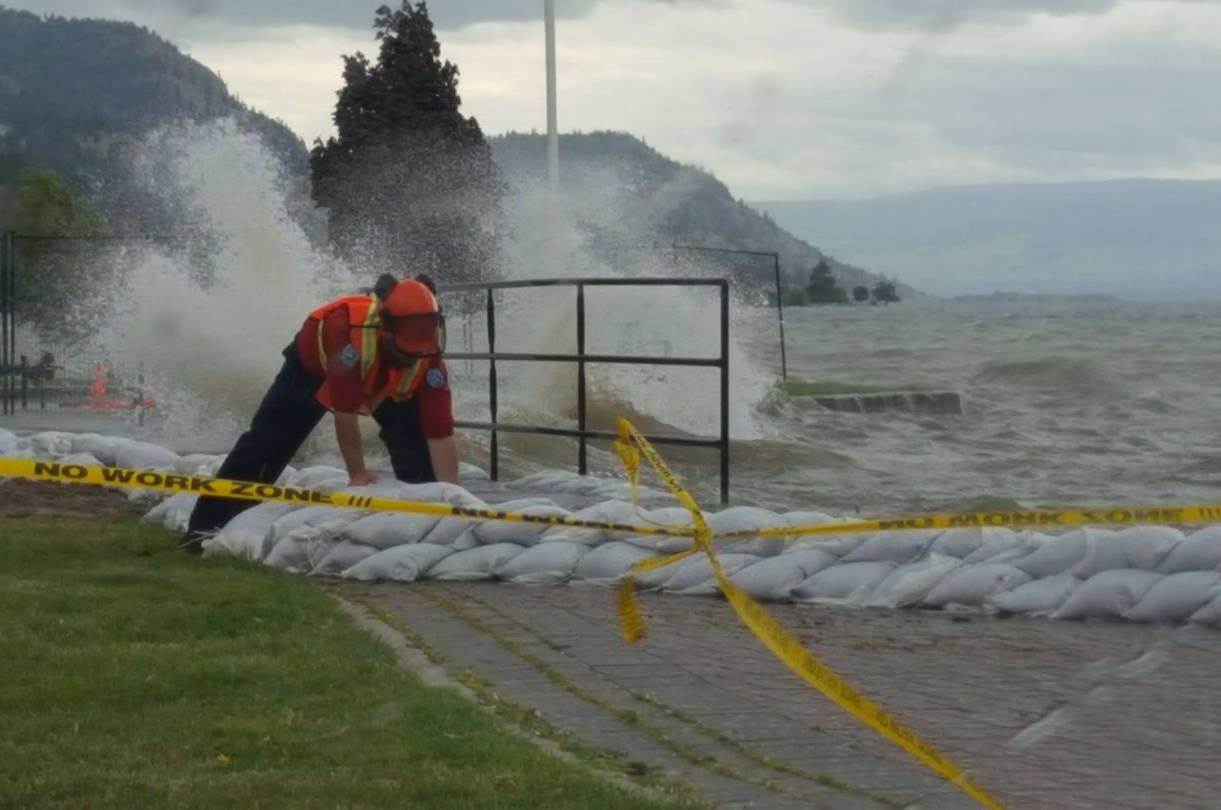
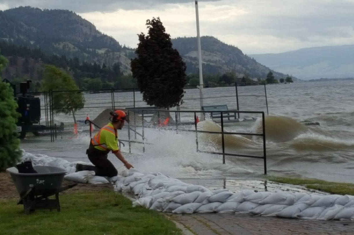
A clean-up effort is underway on Highway 97 south of Peachland after high winds sent waves crashing over barriers designed to protect the highway from the high waters of Okanagan Lake.
At this point, there is single-lane alternating traffic getting through as highway crews clean up debris on the road near Antlers Beach.
Winds have died down, allowing traffic to begin to flow.
According to Ministry of Highways operations manager Jeff Wiseman, a lock-block wall that was installed about 10 days ago, toppled over due to the waves, but continued to act as a break-water, as designed.
Wiseman told the Capital News that the highways’ ministry is currently bringing in more protective material in the form of rip-rap, with plans to lay it along the lake between Antlers Beach and Peachland, a five kilometre stretch.
Wiseman said the integrity of the highway was not threatened in the wind event but they are working hard in preparation for more winds in the forecast.
Those same high winds ripped a tiger dam along Beach Avenue free from the shoreline. District of Peachland crews were working hard Thursday evening to reinstall the water barrier.
There is no estimate for when the highway will be re-opened in both directions.
—-
UPDATE: 3:30 p.m.
The wind has moved in and is hammering communities up and down the lake.
In Peachland, Antlers Beach is entirely under water and the lake is crashing onto the highway, knocking over cement barriers placed earlier this week.
DriveBC is reporting debris on the highway in Peachland and motorists are being warned to expect delays as crews work on scene. The highway is currently single-lane alternating.
A severe thunderstorm watch is stil in place for the North Okanagan and Shuswap region.
More to come.
—�Ĕ
UPDATE: 10:30 a.m.
A severe thunderstorm watch has now been extended to include the North Okanagan and Shuswap region and is expected to extend further.
Environment Canada reports a low pressure system will move into the BC interior this afternoon bringing unsettled weather conditions.
“Thunderstorms will develop ahead of the front. Some of the thunderstorms have the potential to become severe this afternoon and may be capable of producing strong wind gusts, large hail and heavy rain,” states Environment Canada.
“Large hail can damage property and cause injury. Strong wind gusts can toss loose objects, damage weak buildings, break branches off trees and overturn large vehicles. Intense lightning is likely with any thunderstorm that develops.”
Meteorologists want residents to remember that severe thunderstorms can produce small tornadoes and heavy downpours are likely to cause flash floods and water pooling on roads.
“Lightning kills and injures Canadians every year. Remember, when thunder roars, go indoors!”
Severe thunderstorm watches are issued when atmospheric conditions are favourable for the development of thunderstorms that could produce one or more of the following: large hail, damaging winds, torrential rainfall.
—-
ORIGINAL: 9 a.m.
Winds are expected to whip up waves later today and that will test the protection measures placed around the lake.
Environment Canada has forecasted a change in weather with winds expected from 30 to 50 kilometres per hour by Thursday afternoon, prompting CORD Emergency to remind property owners on Central Okanagan lakes to monitor flood protection measures and bolster if necessary.
As of today, Okanagan Lake level is at 343.249 metres above sea level, a slight increase from yesterday’s morning measurement of 343.248 m as measured by Environment and Climate Change Canada. Kalamalka Lake went from 392.438 yesterday morning to 392.437 today.
“Crews are reviewing flood protection this morning, making repairs where necessary and working to remove water from streets flooded from groundwater coming to the surface through storm drains,” reads the latest press release on the matter, from the emergency operations centre.
“People are reminded to stay off flood protection measures. Jumping or walking on gabions or water dams is a public safety concern and could damage or undermine the device causing ruptures and significant water flows.”
While committed to responding to the flood risks, Emergency Operations Centre (EOC) personnel are also planning for the demobilization and recovery period. Residents should keep all flood protection measures in place until the EOC issues information on what actions to take to begin the recovery.
All other evacuation alerts and orders remain in effect. Check out the map at www.cordemergency.ca/map and search by address to determine if an area is under alert or order, or to find the closest sand and sandbag locations.
For more information, visit , sign up for e-updates or call the information line at 250-469-8490.
For municipal information such as boat launch, park and beach closures, and water quality advisories, visit their websites:
City of ��������
City of West ��������
District of Lake Country
District of Peachland
Regional District of Central Okanagan
Westbank First Nation
Keep informed by signing up for e-updates at , or call the information line at 250-469-8490.


