The weather forecasters and environment managers for the Okanagan Valley are still trying to understand the interlocking elements that created widespread flooding issues this spring.
While the snow began to fall later in December due to an unusually warm and wet fall, it was a pretty normal winter until extreme weather conditions beginning in about mid-April culminated in a catastrophic event the first weekend of May.
Okanagan area meteorologist Doug Lundquist said the crux of the flood inducing concerns, largely the snowpack and impact of rainfall, now appear to be subsiding as we get into the month of June.
“We’re looking for it to be pretty dry over the next 10 days. Any heavy rainfall can change the situation quickly while gusting winds can also cause damage while the lake levels are high right now so we’ll have to keep an eye on that,” said Lundquist.
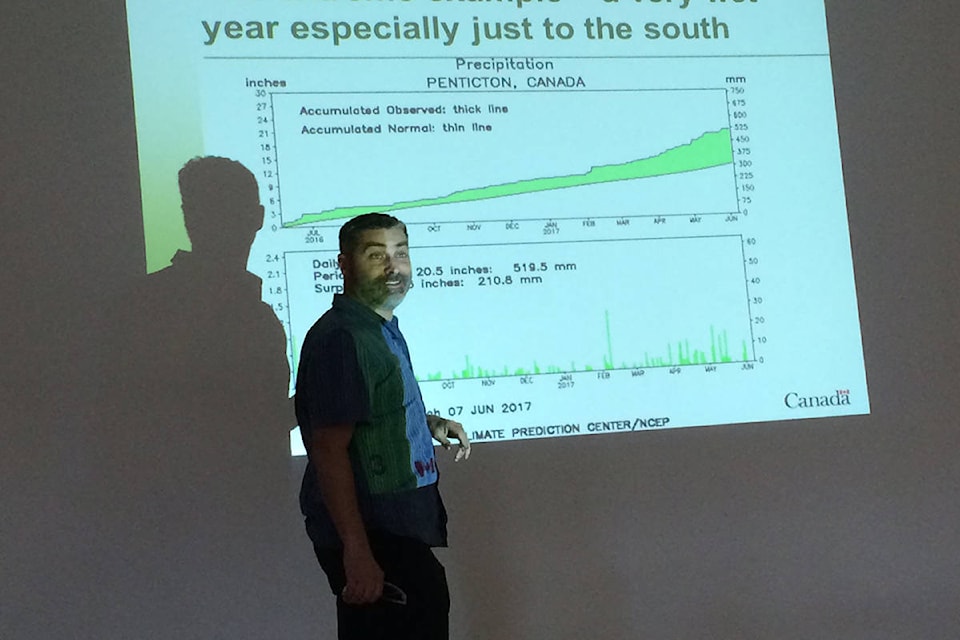
Speaking at a community flood recovery forum hosted by the District of Lake Country on Friday, Lundquist said the combination of weather variables left it hard to anticipate the extent of the flooding that began in May.
Among those variables, he said, was the late arrival of snow, the heavier level of rain in late fall that saturated the ground, the heavy rainfall that hit the valley in late April and early May followed by more snow and then rain again which accelerated the snowpack melt.
“What was unusual leading up to the May weather event was the high level of humidity combined with the dew point percentage (moisture level in the air), ” said Lundquist.
“Normally, that dew point level is below zero on a hot dry day, and between 8 and 10 on a spring day. On the day before the May 4 storm, the dew point levels registered between 15 and 16, which is very rare.
“So what happens is the snow normally evaporating into the atmosphere as it melts, instead it was condensing on the ground and accelerating the rate of snowmelt. That’s what started the creeks bursting over the creek banks and carrying all that debris downstream.”
Lundquist said the role the high level of water saturation in the ground, and how that affected the groundwater, remains a hard thing to measure in terms of impacting the degree of flooding that resulted.
“We have seen saturation occur before at high levels and never seen the result that we saw this year. So what was different about this year compared to other years with similar conditions is something we will have to take a look at,” he said.
For Lake Country, the challenges of the flooding may have diminished but carry on until the Wood Lake and Kalamalka Lake water levels begin to recede.
“It has been a huge task and we’re not at the end of it yet,” said Lake Country engineering technician Matthew Salmon.
“And the recovery task is going to be equally challenging.”
That process will include what to do with the 100,000 sandbags filled with about 1,000 cubic metres of sand, and the $200,000 estimated cost to repair the municipal water intakes for the Oyama Creek and Vernon Creek watersheds.


