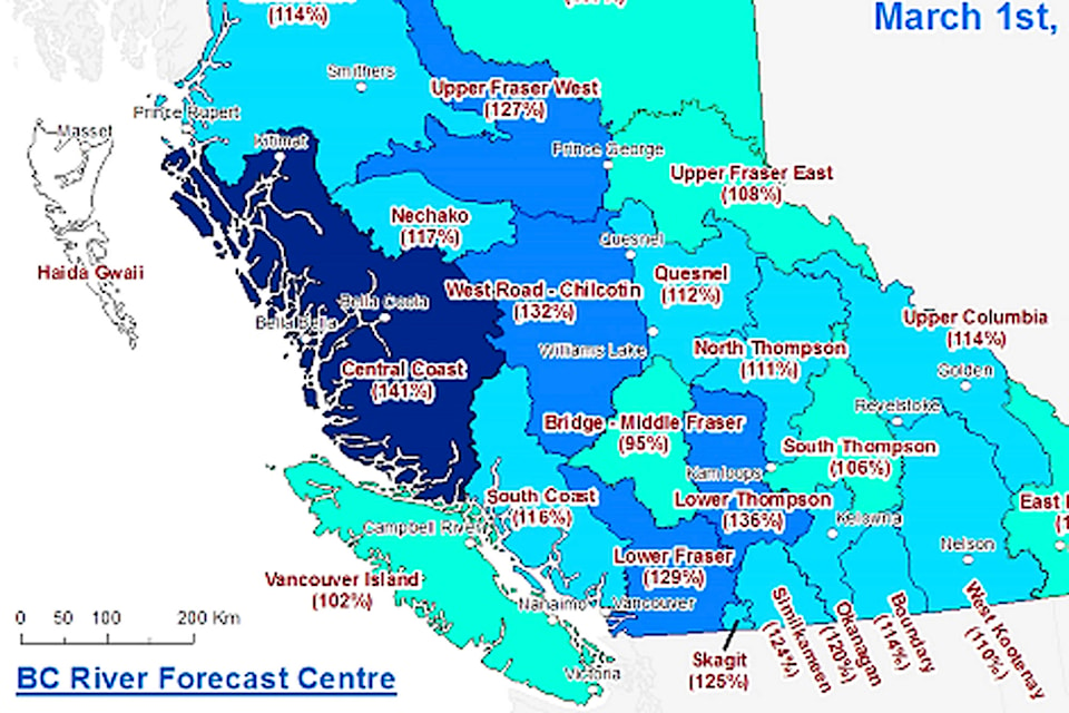
With snow pack levels higher than normal for this time of year and La Ni帽a conditions expected to lead to a cool, wet spring, the B.C. River Forecast Centre is keeping an eye on possible flooding in the coming months.
According to the forecast centre鈥檚 most recent snow survey and water supply bulletin dated March 1, current conditions reflect an elevated risk for freshet-related flooding.
Provincewide, the snow water index tracked by the river forecast centre is at 114 per cent of normal. In the South Thompson watershed, which includes the Shuswap, the snow pack is less than the average being observed across the province at 106 per cent of normal. Further south, the levels for the Okanagan are at 120 per cent of normal, and the Similkameen watershed is 124 per cent of normal. The Upper Columbia Watershed is at 114 per cent of the normal amount.
In a typical year, approximately 80 per cent of the annual snowpack provincewide has accumulated by early March. Environment and Climate Change Canada is predicting La Ni帽a conditions for the rest of the spring, which could lead to delayed snow melt and snow accumulating later in the year than normal.
According to the river forecast centre, whatever happens with the snow pack, weather conditions later in the spring when the snow begins to melt are the most important factor in possible high water events. The snow survey notes that flooding is possible in years with normal or below normal snow pack, while high snow packs do not typically result in flooding unless there is significant contributing weather. According to the snow survey, weather conditions from April to June determine the rate of melt. Heavy rainfall in those months can also contribute to high lakes and swollen rivers.
The river forecast centre will release their next update on conditions on April 9.
Like us on and follow us on


