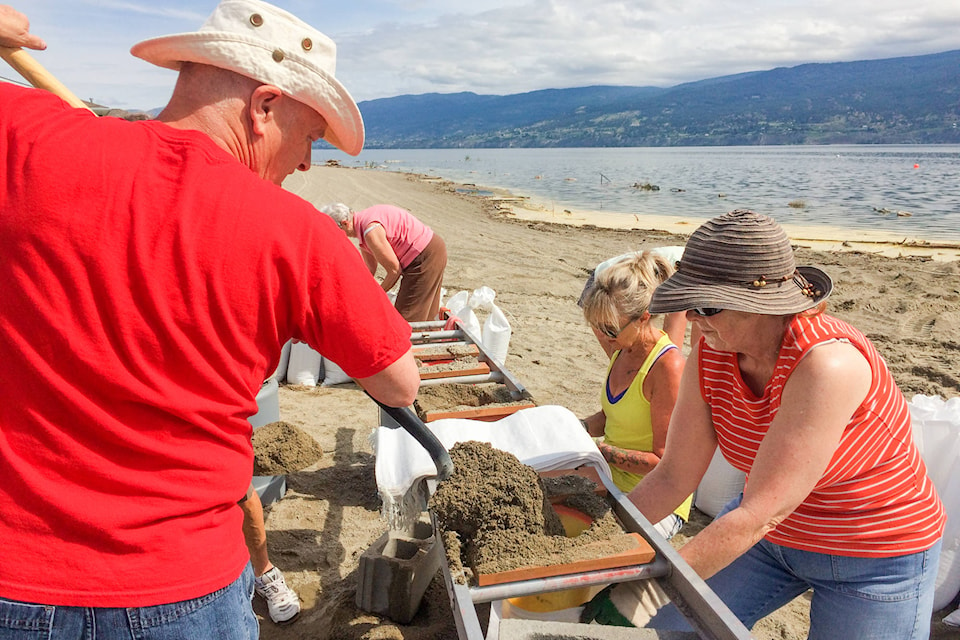
The Okanagan Valley has a long way to go before we can say we’re safe and dry.
According to the latest release from Central Okanagan Emergency Operations, it could be weeks before lake levels finally peak.
On Thursday, Environment Canada reported Okanagan Lake reached 343.17 metres, a two-centimetre rise over the May 31 measurement. The lake is now predicted to peak in mid-June, possibly as high as 343. 25 metres. By comparison, the 1948 flood peaked at about 343 metres.
Snow remaining at high elevations is a concern for officials like Dale Kronebusch, emergency services supervisor for the Regional District of Okanagan-Similkameen. White peaks on Apex and other mountains mean there is still snow waiting to melt and be carried into the creeks, rivers and lakes.
The current weather forecast for rain and storms doesn’t ease the situation, with the rain now helping the snow to melt faster, Kronebusch said.
Weather warnings for the Okanagan Valley forecast severe thunderstorms capable of producing heavy rain.
“Isolated thunderstorms that are capable of producing 15+ mm of rain over a relatively short period of time are possible today,” reads the Environment Canada alert. “Heavy downpours can cause flash floods and water pooling on roads”
Penticton weathered a thunderstorm and winds earlier this week, but city officials are continuing to plan for more bad weather.
“The city survived the storm last night. We are still conducting inspections but initial reports are good,” said Penticton CAO Peter Weeber on Tuesday. “Our focus is to continue to repair and enhance protection measures around the city in anticipation of a series of weather events over the coming weeks.”
Weeber said the sandbagging has been tested at the current water level and held, but rising water levels are still a concern, as is the ongoing rain and wind in the South Okanagan.
The flood protection around the Penticton Yacht Club marina is maxed out, according to Weeber.
Weeber said the marina club house had about two inches of flooding, but the marina overall is in good shape after damage to the breakwater from last week’s windstorm was repaired.
“Ground water has caused us some grief in the lakeside pump station but it is manageable,” said Weeber.
Kronebusch also said protection measures seem to be holding up in communities around the regional district.
“We are starting to look at concentrating around Osoyoos Lake, assisting with the Osoyoos Indian Band and the town of Osoyoos,” said Kronebusch. “The river is starting to flow the other way now.”
Kronebusch explained that water is crossing into the United States and building up against the dam.
“There are large volumes of water coming that way, so it is starting to flow back into Osoyoos Lake. That is where our concern is right now,” said Kronebusch.
Tuesday evening, Summerland declared a State of Local Emergency for the Trout Creek area, concerned over the effect of rising ground water on Summerland’s electrical system.
“In some isolated areas, water has now reached elevations high enough to submerge the electrical connections in underground vaults and junction boxes,” reads the announcement. “Although the electrical cabling is rated to be submerged in water, the connections are not.”
More:
The risk is water in contact with the connections could become electrified and carry the charge to the surface, creating a public safety risk. Power was turned off to a series of properties on Johnson Street, Dale Avenue, and Lighthouse Landing.
Some Trout Creek residents are reporting that Okanagan Lake is coming closer and closer to their homes.
More:


